Steam era Maps of the W.A.G.R.
|
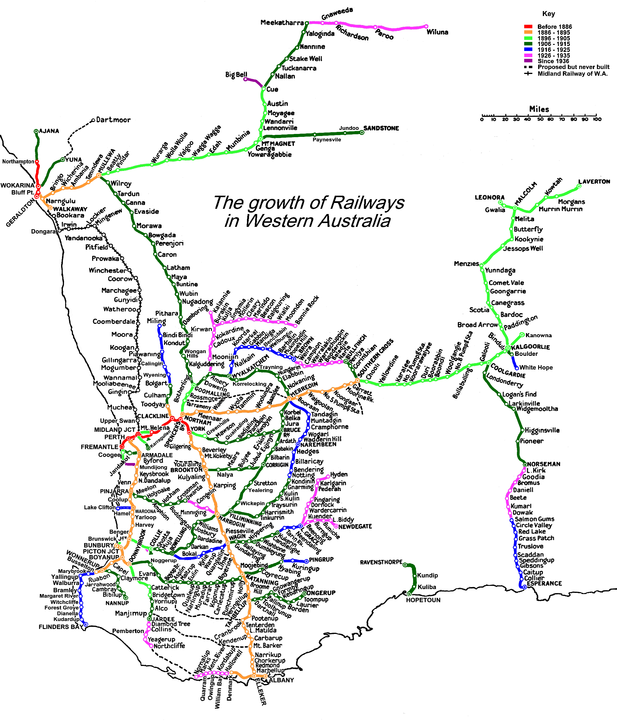
This map is intended to show the development of the W.A.G.R. narrow gauge system. It does not list every station on the system (there isn't room at this size). It does not show when lines closed, nor does it show the changes which came about as the result of the arrival of the Standard gauge from the east. Some of the lines on the map (e.g. Waroona - Lake Clifton) had very short lives and so not all of the lines were contemporary with one another. It does show roughly the intended course of some lines which were surveyed but never built (there may be others which I have missed). Within these limitations I hope that it is useful. |
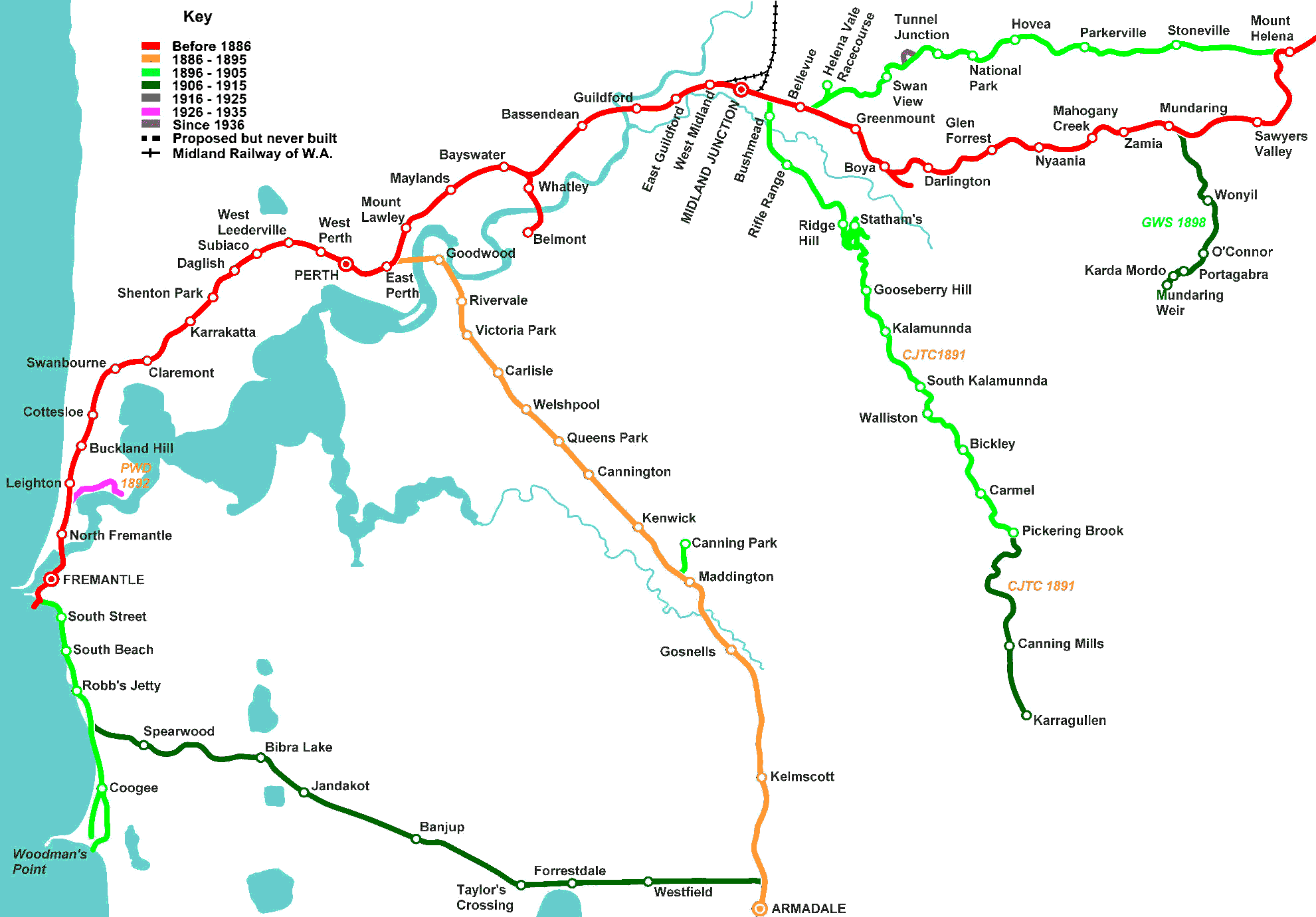
| I have also added a blow up of the Perth area as the large map is too congested for the detail. Some of the names on the map below have now changed (e.g Buckland Hill is now Mosman park), new lines have appeared since the end of the steam era and others are gone. The map is consistent with the early 1940s before extra stops for the railcars appeared and then the standard gauge changed everything. Lines which were taken over by the WAGR have their original construction date shown alongside. |